Community
The Brisbane River: The City's Defining Feature
The river that gave the city its name and shape continues to define how Brisbane lives and moves.
Community
The river that gave the city its name and shape continues to define how Brisbane lives and moves.
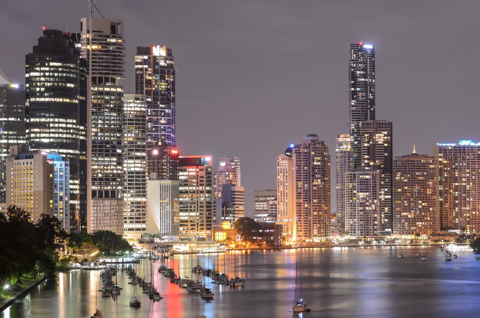
The Brisbane River, winding through the city's inner suburbs in the series of meanders that have given Brisbane its characteristic peninsular neighbourhoods, is the defining physical feature of the city and the element that most clearly distinguishes Brisbane's urban form from the other Australian capitals. The river's sinuous path through the inner city creates the constant visual presence of water in the city landscape and the waterfront geography that real estate, infrastructure planning, and the city's public life all respond to.
City Cat ferries, the fast catamaran service that operates along the river from the University of Queensland in the west to the North Shore in the east, provide the water transport alternative to road and rail that few other Australian cities maintain. The City Cat service's combination of the practical transport function and the tourist attraction of river travel through the city's inner precincts makes it simultaneously an effective commuter service and one of Brisbane's most distinctive urban experiences.
The river's flood history has been the most significant natural challenge that Brisbane has faced, with the major floods of 1974 and 2011 and the significant 2022 flood inundating thousands of properties and causing billions of dollars in damage. The Somerset and Wivenhoe dams upstream provide the flood mitigation infrastructure that reduces (but does not eliminate) the flood risk, and the 2011 flood's damage drove the investment in flood mapping, community education, and development controls that have improved the city's resilience to the flooding that the river's geography makes an enduring risk.
The riverside walkways and parklands that extend along the river through the inner suburbs, connecting South Bank, the CBD, New Farm Park, and the garden precincts of the inner south, provide the linear public open space that the river corridor enables and that Brisbane residents use extensively for the cycling, running, and recreational walking that the flat, continuous paths accommodate. The riverside trail network is one of Brisbane's most significant public assets.
This article was compiled by AI from the sources linked above and screened before publishing. See our editorial standards.
About this article
Published by The Daily Brisbane
More in Community